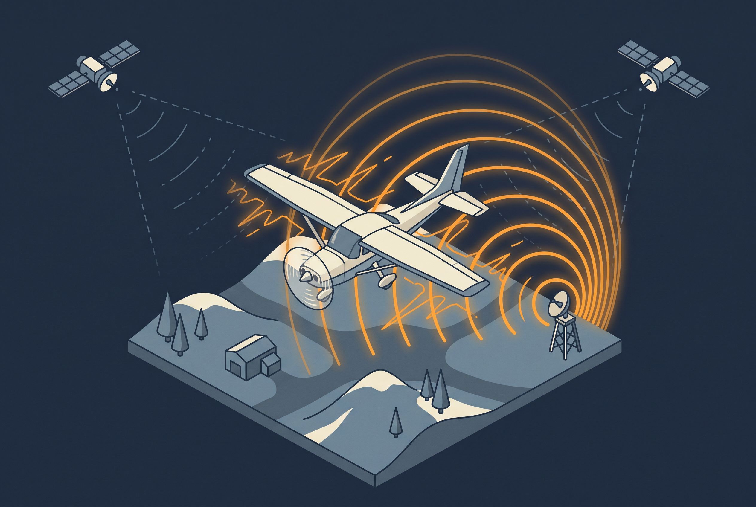
In 2024, the National Land Survey of Finland flew its usual aerial photography and laser scanning season, and most of it went well. Intentional interference with satellite positioning in the southeast spoiled part of the photography, though, and the agency reported that laser scanning data was missing for the Kouvola region. As a result, the Finnish Forest Centre could not collect forest resource data there as planned, and the gaps in the imagery created problems for the control of EU agricultural subsidies. The aircraft, the sensors, and the weather were fine. What failed was the positioning signal that every pixel and every LiDAR point depends on.
The problem has not gone away since. In July 2026, EASA published the fourth revision of its safety bulletin on GNSS interference and warned that incidents are growing in severity and sophistication. Aviation gets most of the attention, but the same satellite signals guide survey aircraft. This article explains what jamming and spoofing do to an aerial survey, how to read the interference maps, what operators can do about it, and where ground stations and nationwide reference networks help and where they do not.
Jamming and Spoofing Are Different Problems
Jamming means a transmitter overwhelms the weak signals arriving from the satellites. The receiver loses satellites, its accuracy drops, or the position disappears completely. Spoofing means a transmitter sends false satellite signals, so the receiver keeps working but reports a wrong position. EASA treats spoofing as the greater risk for air operations, and the reason is easy to understand: a missing position is easier to handle than a convincing wrong one.
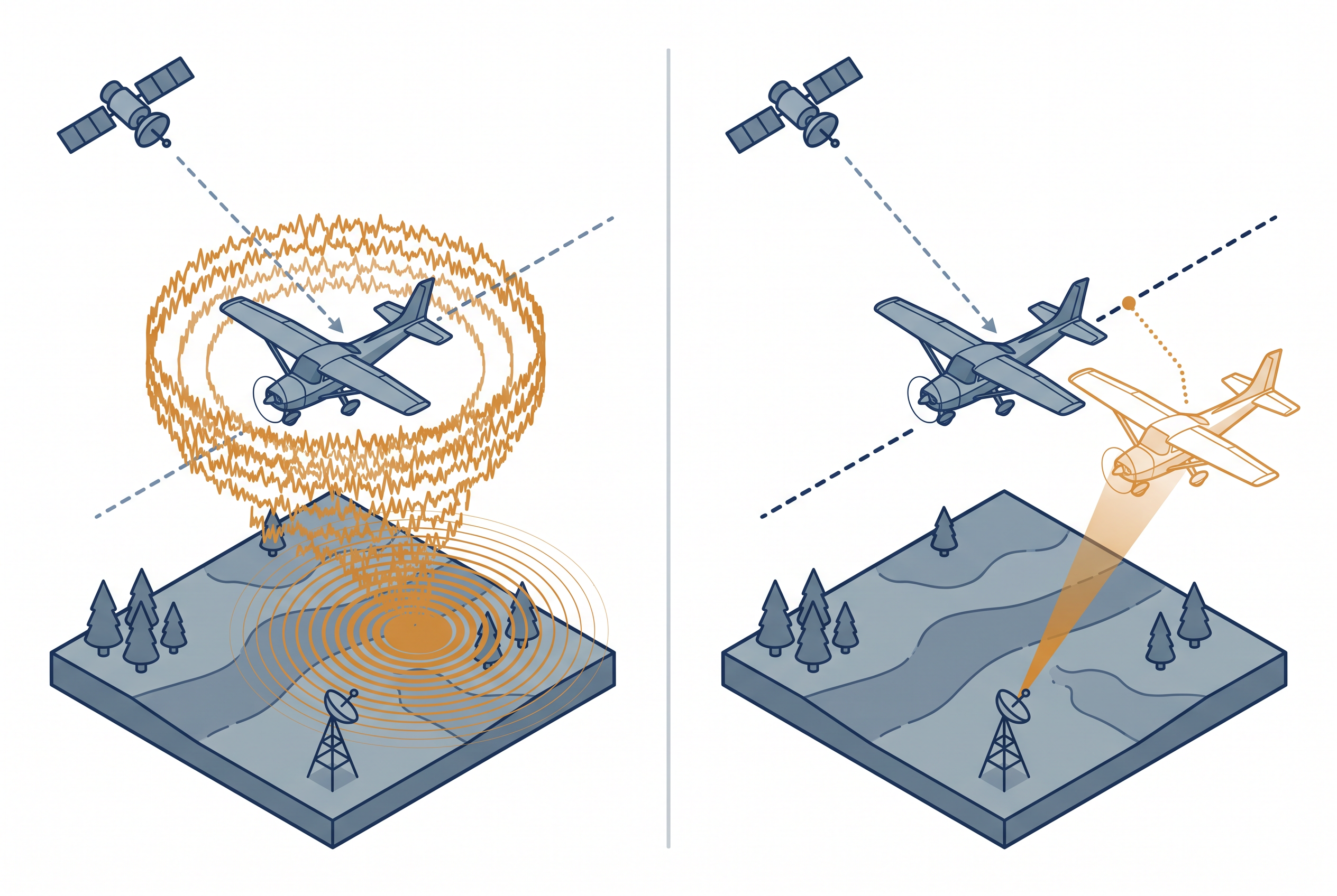
For an aerial survey, the two problems cause different kinds of damage. Jamming creates gaps in the GNSS record. The IMU carries the trajectory through each gap, and how far it drifts depends on the length of the gap and the grade of the IMU, the same trade-off described in GNSS and IMU trajectory quality. Once the signal returns, the receiver also needs time to recover its full accuracy. Spoofing is harder to see in the data. A trajectory built on false positions can look smooth and consistent, and strip matching will not reveal it, because strip matching only checks that the strips agree with each other. Catching spoofing requires a comparison against something that did not come from the aircraft.
Reading the GPSJam Map
GPSJam is a free map that shows where aircraft report poor navigation accuracy. Most aircraft broadcast an accuracy value in their ADS-B messages. The map collects those reports over 24 hours and draws them as hexagons: green where more than 98 percent of aircraft reported good accuracy, yellow where 2 to 10 percent reported low accuracy, and red where more than 10 percent did.
Three things you will have to keep in mind when you using this map for planning.
- First, it shows low reported accuracy, not proof of jamming, and the data does not say which navigation system the aircraft was using.
- Second, aircraft fly high and have line of sight to far more possible interference sources than a receiver on the ground, so a red hexagon does not mean a ground crew nearby had a bad day. A survey aircraft flies lower than an airliner but well above a ground crew, so its experience can differ from the map in either direction.
- Third, a hexagon without color is not a clean area. It means that no aircraft or no receivers contributed data.
Within those limits, the map is a good first screen. The site’s FAQ lists the Baltic Sea region, the Black Sea, the Eastern Mediterranean, and the Persian Gulf among the places where interference is regularly observed. EASA publishes a second view, a list of affected regions that is updated weekly from aircraft reports and ADS-B data. Neither source replaces a check for your specific project area and flight dates.
Further reading
- GPSJAM FAQ | John Wiseman
Explains how the hexagons are calculated, what low navigation accuracy can mean, and why the data has gaps. - EASA Updates Safety Information Bulletin on GNSS Interference | EASA
Announces Revision 4 of the bulletin, published July 3, 2026, and points to the weekly list of affected regions. - EASA Updates GNSS Guidance as Jamming and Spoofing Surge | Geoawesome
Reads the aviation bulletin from the viewpoint of surveyors, mappers, and drone operators.
How Interference Reaches the Final Data
Interference rarely produces an error message in a delivered dataset. It produces patterns: parts of a flight line shifted against their neighbors, steps where the trajectory was bridged, and local inconsistencies that do not match any terrain feature. A gnss.ae article on GNSS failures describes these artifacts for drone data, and the logic is the same for crewed aircraft, because every point in a LiDAR dataset is built from the trajectory.
LiDAR and photogrammetry are not equally exposed. A LiDAR point is computed directly from the position and orientation of the aircraft at the moment of the pulse, so a weak trajectory passes straight into the point cloud. Strip adjustment can remove disagreement between overlapping strips, but it cannot fix a block that is consistently wrong. An image block has more redundancy, because overlapping images can be tied together by matching features, and control points can then anchor the result. That gives photogrammetry more room to recover from a poor trajectory, although a recovered block still costs processing time and control effort. The Finnish Geospatial Research Institute is studying exactly this question in its GNSS-Itä project, which develops real-time detection of jamming and recommendations for minimizing the effect on aerial imagery.
What Survey Operators Can Do
Most of the useful steps happen before the aircraft leaves the ground. Check the interference maps for the project area and the weeks before the flight, plan flight windows with some flexibility, and choose an IMU grade that matches how long the trajectory may have to rely on it alone. Contracts deserve attention too. A project in an affected region should state who carries the cost when interference forces a reflight, because the same risk can otherwise surface later as a dispute.
During and after the flight, the goal is to know what actually happened. Monitoring satellite count and signal strength in the aircraft gives the crew a chance to react, and logging raw observations lets the processing team judge quality afterward instead of trusting a final trajectory blindly. After processing, compare the result against independent check points and read the trajectory quality report line by line. Reporting interference to the national authority also helps. The National Land Survey of Finland has noted that current situational awareness rests largely on user reports, so every report improves the picture for everyone else.
Equipment helps, with limits. Tracking several constellations and frequencies improves resilience, but several constellations use nearby frequency bands, so one interference source can affect them together. Galileo’s OSNMA, operational since July 2025, lets compatible receivers verify that navigation data really comes from Galileo. That makes spoofing harder and does nothing against jamming. Specialized antennas that suppress signals from certain directions are described in the research literature as strong protection against jamming, but they are specialized hardware and not a standard option on every survey system.
What Ground Stations and Nationwide CORS Can Add
A base station or a CORS network supplies corrections that remove shared errors from the aircraft trajectory, as described in the article on trajectory quality. That role does not extend to interference. A correction can only improve observations that the aircraft receiver actually recorded. If the receiver was jammed, there is nothing for the base station to correct. The base station can also be a victim itself: the Jammertest event in Norway deliberately targeted a Finnish reference station to learn how such stations behave under interference. Finally, a station on the ground does not see what the aircraft sees. For the same line-of-sight reason that limits the GPSJam map, clean data at the base does not prove clean data in the air.
Where reference stations help is in monitoring and in redundancy. A station that continuously logs signal quality works as a sensor, and a national network works as a sensor grid. A 2023 presentation by the Finnish Geospatial Research Institute describes a monitoring service built on the national reference network that has detected jamming incidents, including one in Helsinki. Slovenia has a research project to identify intentional interference in its CORS network. The National Land Survey of Finland has proposed a “weather advisory” for GNSS interference built on this kind of data. A dense network also gives processing software several baselines to choose from when one station is affected.
This suggests a division of labor. A nationwide CORS network is the cheaper place to get corrections and monitoring, because many users share its cost. A temporary base station near the project area makes sense mainly where network coverage is thin or baselines would be too long, and the cost of deploying and operating it should be weighed against that narrow benefit. Neither one protects the aircraft receiver, so neither one replaces the independent checks described next.
Further reading
- Interference Spoiled Aerial Photography in Southeastern Finland | National Land Survey of Finland
The agency’s account of the 2024 flight season, its consequences for data users, and its proposal for a GNSS interference advisory. - NLS Exposed Its Equipment to GNSS Interference in the Jammertest Event | National Land Survey of Finland
Describes controlled jamming and spoofing tests on survey receivers and a reference station. - GNSS-Itä: Resilient Positioning in Eastern Finland | Finnish Geospatial Research Institute
A research project on real-time jamming detection and on limiting the effect of jamming on aerial imagery and laser scanning. - Care4SIGNAL: Risk Assessment of GNSS Interference in the Slovenian CORS Network | University of Ljubljana
A project on detecting intentional interference using a national reference station network.
Independent Checks Without a Large Control Budget
Ground control is expensive, and the usual way to measure it adds a complication. Control points are normally measured with GNSS receivers on the ground, and those receivers can be jammed too. The Jammertest tests included a professional RTK receiver of the type surveyors use, operated under five different jammers, which shows that field equipment is exposed in the same way as aircraft equipment.
In my view, the practical answer is a small number of well-placed check points instead of dense control. Measure them with a method that does not depend on the same satellite signals, such as a total station tied to existing benchmarks, or use stable features with known coordinates from earlier surveys. A comparison with a previous national dataset on stable surfaces such as roads and building roofs can serve the same purpose. A few such checks cost far less than a full control network, and they answer the question that matters after an affected flight: whether the block sits where it claims to sit.
Should the Industry Plan for This?
The trend suggests yes. The National Land Survey of Finland reported about 1,200 interference notifications in Finnish aviation in 2024, compared with 239 the year before, citing the national communications agency Traficom. IATA has reported that GPS signal-loss events increased by 220 percent between 2021 and 2024, and EUROCONTROL has estimated that up to 38 percent of European en-route traffic passes through regions that are intermittently affected. Survey flights are a small part of that traffic, but they share the same airspace and the same signals.
For decades, the geospatial industry worked on making positioning more accurate, faster, and cheaper. The next requirement is knowing whether a position can be trusted. In practice, that points toward several developments: tender documents that name interference risk and reflight rules, processing software that flags suspect trajectory segments, sensor specifications that state how long a system can bridge a GNSS outage, and regional monitoring that gives survey planners a forecast instead of a report after the fact. The GNSS-Itä project, which runs until March 2027 with industry partners Kelluu and Septentrio, is one early example of this work.
The consequences reach beyond a single project. A national program that revisits an area only every five to ten years, as discussed in the article on temporal resolution, cannot easily absorb a lost flight season, because the next chance may be a full cycle away. That makes interference resilience a question of data currency as well as data accuracy, and it connects every decision about sensors, base stations, and contracts to the same question: how long can a map be wrong before someone notices?